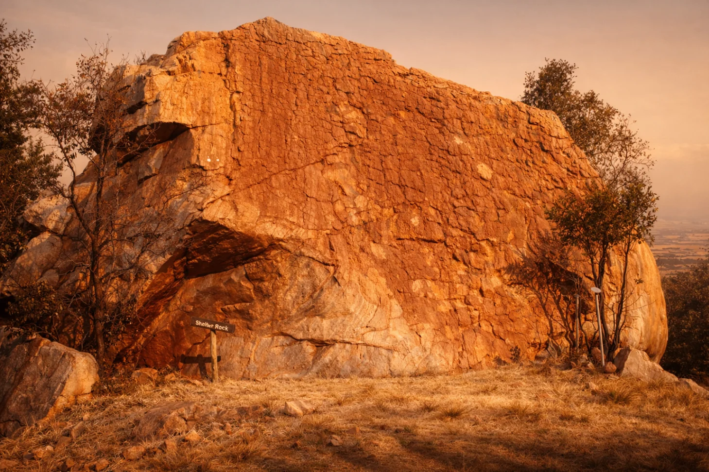
Shelter Rock
The landmark that gives the mountain its name.
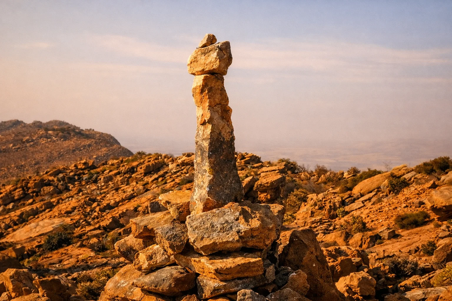
A single, enormous sandstone outcrop that shelters one flank of the ridge. Weather-carved and unmistakable in the late light, it has watched the valley for far longer than any trail marker.
Discover one of the Magaliesberg's most scenic private hiking trails at Shelter Rock, near Hartbeespoort and within easy reach of Magaliesburg, Johannesburg and Pretoria. Our 8 km mountain route combines panoramic views, ancient sandstone formations, indigenous bushveld and remarkable historical landmarks.
With approximately 400 metres of elevation gain and a walking time of 2.5 to 4 hours, the moderately challenging trail offers a rewarding mountain experience for reasonably fit adults and older children. Visitor numbers are deliberately limited, giving hikers the opportunity to enjoy the landscape without the crowds found at some popular destinations.
Book ahead and pay on arrival.
Adults
R100 per person
Scholars
R50 per person
Under 6
Free
Shelter Rock is a privately managed section of the Magaliesberg within the UNESCO Biosphere Reserve. The experience combines a genuine mountain hike with remarkable scenery, natural history and the tranquillity of a trail where visitor numbers are deliberately limited.
Visitor numbers are deliberately limited, allowing you to experience the mountain at a quieter pace. Walk through indigenous bushveld, listen for birdlife and look out for Verreaux's Eagles circling the sandstone cliffs.
The 8 km route takes hikers past ancient sandstone formations, a centuries-old wild olive tree, Boer War fort remains and traces of an Iron Age settlement. These landmarks make Shelter Rock as interesting for its history as for its mountain views.
Located near Hartbeespoort, Shelter Rock is accessible from Johannesburg, Pretoria and the West Rand. The trail offers a rewarding half-day mountain experience, making it an attractive option for a weekend hike without the need for overnight accommodation.
Looking for a hiking trail within easy reach of Johannesburg or Pretoria? Shelter Rock offers an 8 km private mountain route in the Magaliesberg, near Hartbeespoort. The trail combines rocky mountain terrain, panoramic views and historical landmarks, making it a rewarding day-trip destination for visitors from across Gauteng.
Most hikers complete the route in approximately 2.5 to 4 hours, depending on fitness, pace and time spent enjoying the viewpoints. The trail is moderately challenging, with natural, uneven terrain and approximately 400 metres of elevation gain. Visitors should wear suitable hiking shoes, carry sufficient water and allow time for the drive.
Directions to Shelter Rock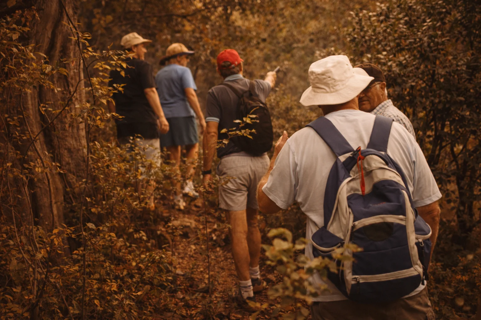
You arrive at base camp before the day gets warm. The valley is still cool, the light still low. A short walk from the parking area, the trail begins where the bushveld thickens.
The first section is a gentle, shaded climb through indigenous trees — wild olive, karee, tamboti, common hook-thorn. Birds move ahead of you through the canopy. The path is uneven but never technical.
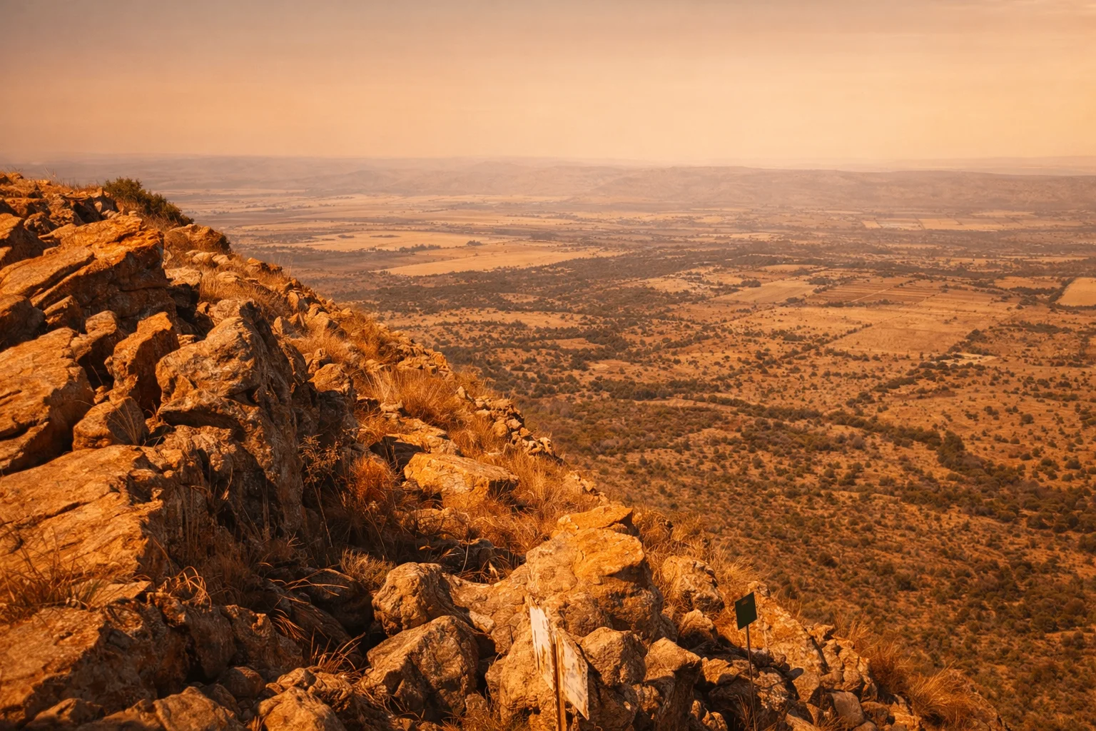
Then the vegetation thins and the sandstone begins. You step onto exposed rock and, for the first time, see how far the Magaliesberg reaches. Hartbeespoort catches the light in the distance. Farmland spreads all the way to the horizon.
You pass the centuries-old wild olive, cross the natural donga where the ravine cuts the ridge, and follow the summit path past the Boer War fort sites. The Shelter Rock formation waits near the highest point.
The descent loops back through a different aspect of the mountain. By the time base camp reappears, you've walked 8 km, gained about 400 m, and spent two to four hours in a place that will feel further from Johannesburg than it actually is.
Follow our 8 km hiking trail through the southern slopes of the Magaliesberg, one of the most accessible mountain hiking destinations for visitors travelling from Johannesburg and Pretoria.
A single, enormous sandstone outcrop that shelters one flank of the ridge. Weather-carved and unmistakable in the late light, it has watched the valley for far longer than any trail marker.
From the summit you can enjoy panoramic views stretching towards Johannesburg, Sandton, Hartbeespoort, the Witwatersrand and the surrounding Magaliesberg landscape — one of the reasons the Boer War fort sites sit exactly where they do.
A living wild olive (Olea europaea subsp. cuspidata) that has stood on the mountain for many centuries. Standing beside it is one of those quiet trail moments that reframes what a Saturday can hold.
Two fort sites sit on the ridge. From the elevated position, it becomes obvious why this stretch of the Magaliesberg mattered in the South African War — the plains open in every direction.
Low stone-walled foundations and terraced ground on the mountain point to earlier occupation. These are informal traces rather than a formally studied or classified archaeological site.
The Magaliesberg is one of the world's oldest mountain ranges, formed from ancient Transvaal Supergroup sandstones. The precise age figures from older signage are being reviewed.
Summer conditions can become hot on the exposed ridge — start early.
“Probably the best day hike we've done in Gauteng. Well-marked, beautifully maintained, and the summit views over the Magaliesberg are extraordinary. The Shelter Rock formation and the centuries-old wild olive make it feel like more than just a hike.”
“Quiet trails, dramatic scenery and a genuine sense that someone actually cares for the mountain.”
“Our teenagers didn't ask for their phones once. Rare and wonderful.”
Moderate. The 8 km route includes roughly 400 m of elevation gain over natural, rocky terrain. Reasonably fit adults and older children handle it comfortably at 2.5 – 4 hours.
Most hikers complete the loop in 2.5 to 4 hours, depending on pace, photography stops and time spent at viewpoints and historical landmarks.
Yes, provided you're reasonably fit and comfortable on uneven ground. The terrain is natural — there are no paved paths — but the route is well-marked and the pace is up to you.
Older children who are used to walking manage the trail well. It is not suitable for toddlers, prams or very young children.
Yes. Send us a WhatsApp to book your hike.
Yes. Solo hikers are welcome, but you must check in at reception first with your planned route and expected return time.
Yes, the trail is marked. A map is provided at check-in and key waypoints are signed on the mountain.
Early morning is best, especially in summer. We are open on Saturdays, Sundays and public holidays from 07:00 to 17:00 in September–April, and 07:30 to 17:00 in May–August. Please arrive before 11:00 so you have enough time on the trail.
Yes. Groups of 10 or more must book in advance. Organised hiking clubs are welcome by arrangement.
No. Dogs are not permitted on the hiking trails, in order to protect wildlife and other visitors' experience.
Yes — parking is available at base camp, close to the trailhead.
Toilets are available at base camp before you set out. There are no facilities on the trail itself.
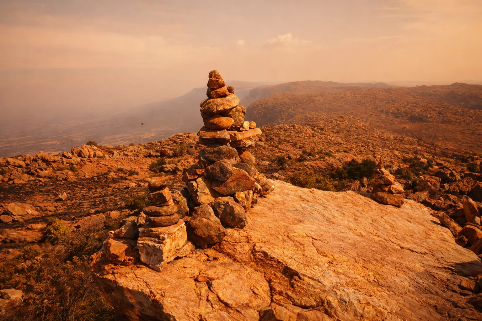
8 km trail · moderate difficulty · private access · Sat, Sun & public holidays · arrive before 11:00 · booking recommended.
Book your adventure
Chat to us on WhatsApp